Site Preparation in NC
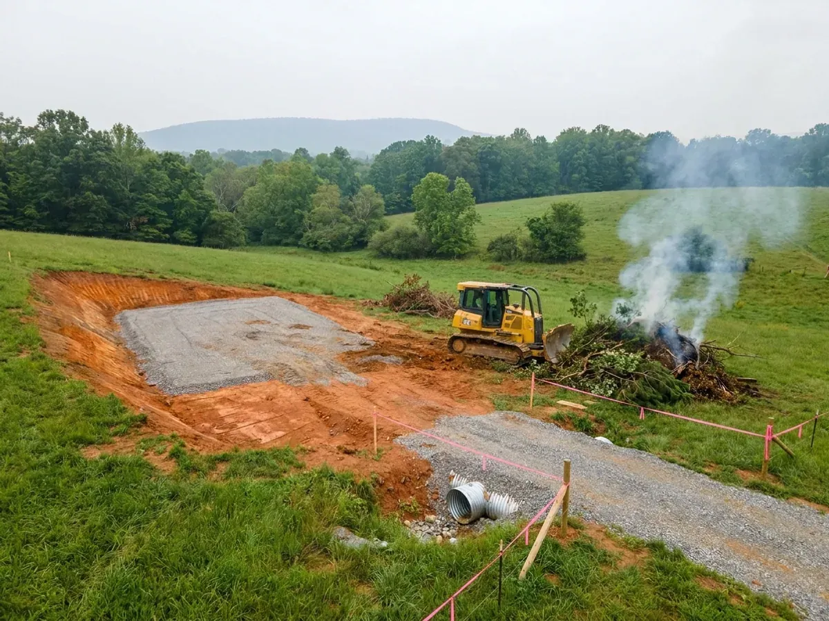
Site work is where a barndominium budget is decided, and in North Carolina it turns on two questions almost nobody asks early enough: how much ground the project will actually disturb, and what colour the topsoil is. Disturb more than one acre on a tract and the Sedimentation Pollution Control Act requires an approved erosion and sedimentation control plan before land-disturbing activity starts, with civil penalties NC DEQ publishes at up to $5,000 per day per violation. And the famous red Piedmont clay is not the soil that heaves — the dark grey-brown one beside it is, which is why this work begins with reading the ground rather than with a machine on it.
How a site preparation project runs
Four stages, in this order. The sequence matters more than it looks: getting engineering and permitting settled before anything is fabricated is what keeps a build from stalling.
Read the ground first
Boundary and topographic survey, then the soil. The USDA Official Series Description for Cecil — North Carolina's state soil, the red clay everyone pictures — classes it as fine, kaolinitic, thermic Typic Kanhapludults with LOW shrink-swell. Iredell, formed over diabase and gabbro a few miles away in the same Piedmont, is Oxyaquic Vertic Hapludalfs with VERY HIGH shrink-swell, slickensides and a perched water table one to two feet down from December through April. Its surface is dark grayish brown, not red. Anyone can check a parcel for free on the NRCS Web Soil Survey before making an offer, and on this building type it is worth doing before the offer rather than after.
Count the disturbance, then get the plan approved
NC DEQ's Land Quality Section states that an erosion and sediment control plan is required when more than one acre of land on a tract is to be disturbed, that the activity must be conducted in accordance with the approved plan, and that enforcement runs to civil penalties up to $5,000 per day per violation plus stop-work orders. Approval comes from a Land Quality Section regional office or from a delegated local government program, and local programs are permitted to be stricter than the state minimum. The acre is counted across the whole tract: pad, driveway, septic area, utility trenching, stockpile and laydown, not the building footprint alone.
Clearing, cut and fill, and a pad that was actually compacted
What this costs is a physiographic-province question. A mountain lot is a bench cut into slope with retained cut, compacted fill and rock excavation to plan for. A Piedmont lot is a residual profile that changes across the parcel, because the weathering front follows the buried rock surface rather than the ground surface — so two column pads thirty feet apart can land on genuinely different material, and a refusal may be a floating corestone rather than bedrock. A Sandhills upland densifies well and usually wants proof-rolling rather than undercut. Tidewater organic ground wants fill imported to raise the pad, and muck removed rather than compacted.
Drainage, driveway and the utility corridor
Water leaves the building before anything else is true. Then the culvert and the drive, then the corridor for power, water and the septic system. Sequence matters more here than in most states: 15A NCAC 18E .0201(c) provides that upon issuance of the Construction Authorization the applicant may obtain a building permit, so on a well-and-septic parcel the county health department's septic approval gates the building permit rather than running alongside it. Clearing a pad before the soil evaluation is the most expensive order of operations available on this building type.
One acre of disturbance, and the plan has to be approved before a machine moves
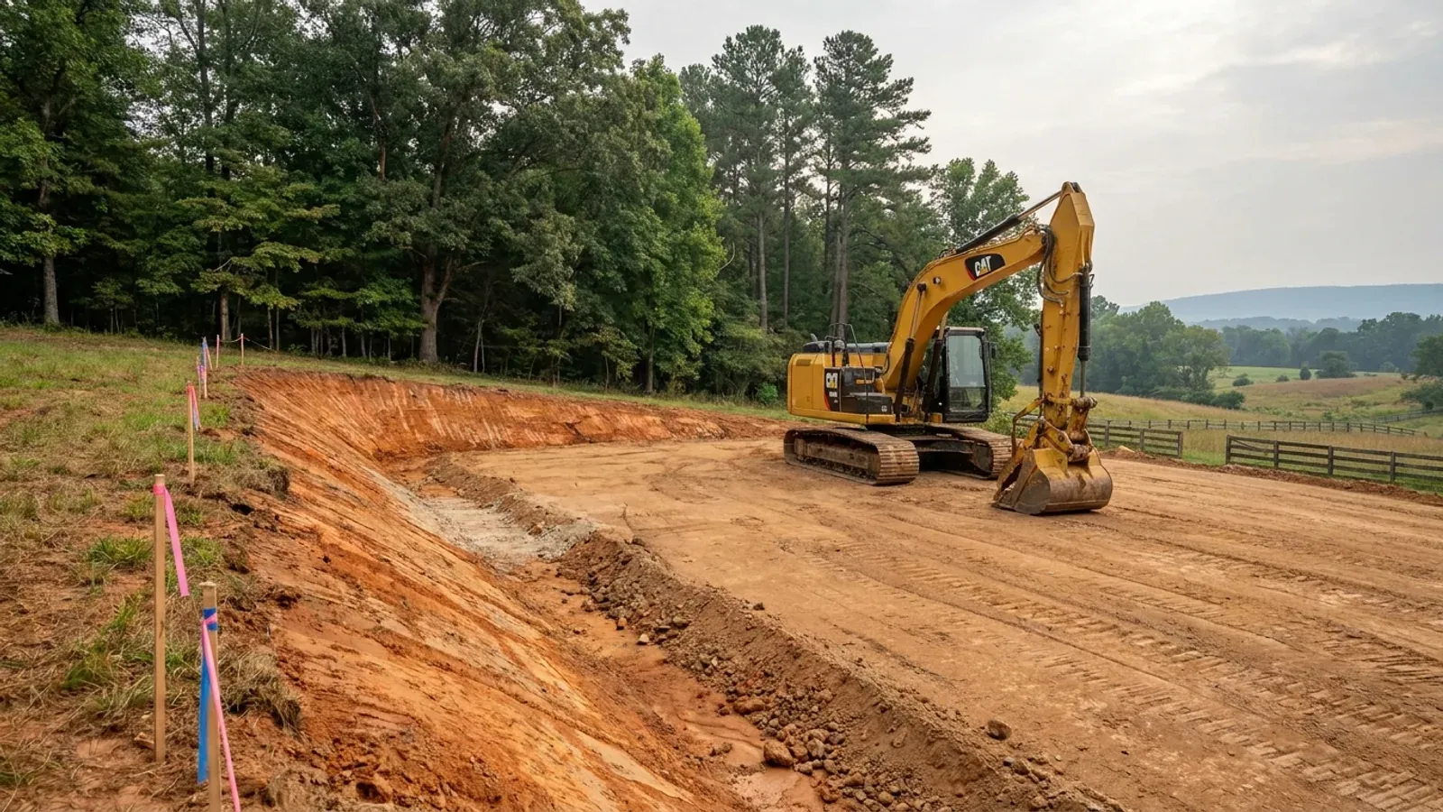
Most rural buyers think of "the build" as the building. North Carolina's Sedimentation Pollution Control Act, G.S. Chapter 113A Article 4, counts land-disturbing activity on a tract — and NC DEQ's own Erosion and Sediment Control page states plainly that a plan is required when more than one acre of land on a tract is to be disturbed, that the work must be conducted in accordance with the approved plan, and that civil penalties run up to $5,000 per day per violation alongside stop-work orders. Now add it up on a wooded rural parcel: a building pad, a long gravel drive with its shoulders and ditches, the septic field and its repair area, the utility trench, the laydown yard and the stockpile. An acre arrives quickly and quietly, and it arrives before anyone has poured anything. Two further things are worth knowing before the excavator is booked. First, the approval may not come from the state at all — DEQ says plan approvals are issued by Land Quality Section regional offices or by local government erosion and sedimentation control programs, and a delegated local program is allowed to be more stringent than the state minimum, so the threshold that governs your tract is the one your county or city actually administers. Second, the plan must be approved before land-disturbing activity begins, not filed alongside it. That is a schedule cost rather than a materials cost, and it is the single item rural North Carolina buyers most often discover from a stop-work order. DEQ's own reporting line for sedimentation complaints is branded 1-866-STOPMUD, which tells you how the state expects to hear about a site that started early.
Where we deliver site preparation
In North Carolina the city limit is a real boundary, but not the one most people expect. There are no independent cities here — every municipality sits inside one of the 100 counties — and under § 160D-202 a city runs zoning, subdivision and the building code one to three miles beyond its own limits, on a scale set by population, while city taxes and city elections stop at the corporate line. Land that looks entirely rural can be inside that extraterritorial jurisdiction, and the mailing address will not tell you. The code itself is not what changes when you cross the line: the State Building Code applies on both sides and enforcement is mandatory everywhere. What changes is who reviews the drawings, what they charge, how the land is zoned, and the ultimate design wind speed the code publishes for your county. Two parcels twenty miles apart can carry completely different engineering.
Serving clients across the entire region.
Every jurisdiction we build in has its own reviewer and its own fee schedule, and the code sets a different design wind speed county by county. The service area pages set out what applies where.
What actually decides the price
Square footage is the number everyone leads with, and it is rarely the one that moves a barndominium budget. These four do.
-
Which province the parcel sits in
North Carolina is four different ground problems and the line between them is sharp. Blue Ridge lots are cut-and-fill on slope — the Edneyville series, the representative mountain soil, is mapped at slopes typically 15 to 95 percent — with rock excavation likely and a driveway that is its own earthworks project. Piedmont is moderate cut on rolling ground over a variable residual profile. The Sandhills is the easy case: the Candor series is grossarenic, meaning a very thick sandy surface, somewhat excessively drained, and it compacts well. Outer Coastal Plain is minimal cut and maximum imported fill, because there is nothing to cut and the pad has to come up out of the water.
-
Whether total disturbance crosses one acre
This is a threshold, not a sliding scale, and it moves the schedule rather than the machine hours. Under the Sedimentation Pollution Control Act an approved erosion and sedimentation control plan is required where more than one acre on a tract is to be disturbed, and the plan must be approved before land-disturbing activity begins. Approval comes from a state Land Quality Section regional office or a delegated local program, and local programs may set stricter requirements — so the number that governs a Wake County tract and a Buncombe County tract may not be the same number even though the state floor is.
-
What the soil actually is, not what it looks like
Colour is the tell and it inverts the usual warning. Cecil, the state soil, is kaolinitic with LOW shrink-swell per its USDA series description — sticky, slow-draining and unworkable when wet, but not a heaving soil. Iredell and the other mafic-derived Piedmont soils formed over diabase, diorite and gabbro are Vertic with VERY HIGH shrink-swell and a winter perched water table. Both look like an ordinary field to someone standing on it. The North Carolina Residential Code adds a second lever: R401.4 leaves it to the building official to decide whether to require a soil test where quantifiable data indicate expansive, compressible, shifting or otherwise questionable soils.
-
Where the water is, and how much fill it costs to get above it
Eastern North Carolina's governing problem is water rather than strength. The Norfolk series of the inner Coastal Plain is well drained with a seasonal high water table 40 to 72 inches down — straightforward ground. The Belhaven series of the Tidewater is a Histosol with 16 to 51 inches of organic material and a seasonal high water table 0 to 12 inches from November to May, and its series description records that excessive drying makes it shrink into hard peds that dry irreversibly. Organic soil is the one North Carolina material that genuinely has to be removed rather than compacted, and the removal is volumetric: all of it, or the problem is not solved.
Site Preparation in NC: common questions
8 questions we get asked most often about building in NC. If yours is not on the list, ask it directly.
Do I need a permit just to clear my own land in North Carolina?
How does a rural build cross an acre of disturbance without anyone noticing?
Is North Carolina red clay going to crack my slab?
Then which North Carolina soil actually does heave?
Will I need a geotechnical report before I can build?
How deep do the footings have to go, and can I insulate instead of digging?
What order does site work actually happen in on a North Carolina parcel?
My lot is in the mountains and it is not on the landslide map. Am I clear?
Keep reading
The pages that answer the next question this one raises.
Ready to put site preparation against a real plan? Start there and the rest follows.
Tell us about the land
Send the parcel ID or an address and we will come back with what can be built on it, the wind load it has to meet, and a realistic budget range. That conversation costs nothing.